About the MPOThe Danville Area Transportation Study MPO leads in the development of the region's long-range transportation plan and short-range transportation improvement program through a partnership among the U.S. Department of Transportation and the Federal Highway Administration, Illinois DOT, local elected leadership, local planning and urban services employees, the business community, and citizens across the Danville region.
Our Committees
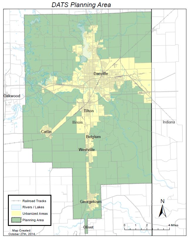
The map above shows the boundaries of the Danville Area MPO which is comprised of a Policy Board, a Technical Committee, Advisory Committee, and Staff. The DATS committees include representatives from: the City of Danville, the City of Georgetown, the Village of Belgium, the Village of Westville, the Village of Catlin, Catlin Township, Danville Township, Newell Township, Georgetown Township, Vermilion County, Danville Mass Transit, CRIS, Vermilion Regional Airport, and the Illinois Department of Transportation.
|
Our MissionThe Danville Area Transportation Study MPO is committed to providing leadership to the region in the planning, funding, and development of a regional multi-modal transportation system; one that promotes personal and social economic prosperity while encouraging sustainable growth and development practices to protect and preserve valuable community and natural assets.
Our Guiding DocumentsThe Danville Area Transportation Study is guided with an annual Unified Planning Work Program (UPWP), a 4-year Transportation Improvement Program (TIP) and a 25-year Long Range Transportation Plan (LRTP).
NEWS & NOTES
|
|