
LAND USE
National trends point towards new policies linking transportation planning with land use planning. A recent and exciting announcement by the United States Department of Transportation (DOT), the United States Department of Housing and Urban Development (HUD), and the United States Environmental Protection Agency (EPA) outlining the creation of a high-level interagency task force and the creating of a "Sustainable Communities Initiative" to better coordinate transportation and housing investments identified the following goals:
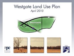
The Westgate Land Use Plan proposes a future land use and development scenario for an interchange area west of the City of Danville and east of the Village of Oakwood in 2010. Scenario alternatives were evaluated for their effect on the transportation network, environment, economic development benefits, and public utility use. Strong transportation connectivity, proximity to regional parks and open land available for development are some of the assets that could bring future growth potential to the area.
The 2005-2006 Comprehensive Plan is the master plan for the future growth and development of the City of Danville. The Comprehensive Plan guides planning and development policy for the city and the one and one-half mile territory adjoining the city limits. The Comprehensive Plan serves as a long-range vision of what we want our city to become, as a tool for making decisions about how that vision should be achieved, and as a specific program of action for reaching our stated objectives. As a long-range vision, the Plan sets forth the values we want to realize as the city changes over the next 20 years and ties those values to the physical development and shaping of the community. It also presents an official policy framework and mapped context for making incremental decisions regarding land development issues. Finally, the Plan outlines the strategies and steps the community can follow to make it a reality.
- More choices for affordable housing near employment opportunities
- More transportation options, to lower transportation costs, shorten travel times, and improve the environment;
- Safe, livable, and healthy communities.
The Westgate Land Use Plan proposes a future land use and development scenario for an interchange area west of the City of Danville and east of the Village of Oakwood in 2010. Scenario alternatives were evaluated for their effect on the transportation network, environment, economic development benefits, and public utility use. Strong transportation connectivity, proximity to regional parks and open land available for development are some of the assets that could bring future growth potential to the area.
The 2005-2006 Comprehensive Plan is the master plan for the future growth and development of the City of Danville. The Comprehensive Plan guides planning and development policy for the city and the one and one-half mile territory adjoining the city limits. The Comprehensive Plan serves as a long-range vision of what we want our city to become, as a tool for making decisions about how that vision should be achieved, and as a specific program of action for reaching our stated objectives. As a long-range vision, the Plan sets forth the values we want to realize as the city changes over the next 20 years and ties those values to the physical development and shaping of the community. It also presents an official policy framework and mapped context for making incremental decisions regarding land development issues. Finally, the Plan outlines the strategies and steps the community can follow to make it a reality.
DANVILLE AREA TRANSPORTATION STUDY DOCUMENTS.
Westgate Land Use Plan
|
2016
|